Welcome to Smart Fishing Life
Kastave autonomous fish scouting robot at the edge of a freshwater lake
AI SONAR MAPPING

Kastave Product

An autonomous fish scouting robot that maps underwater structure before you cast An autonomous fish scouting robot
that maps underwater structure before you cast

RESERVE NOW
Auto Scan 3D Map $10 = 25% Off

What is Kastave?

Understand reachable water in minutes before you cast.

The hunt for a personal best begins before the first cast. Beginners often guess. Serious anglers scout first. They study satellite images, contour lines, access points, weather, water temperature and seasonal movement before they ever reach the bank.

Once they arrive, the scouting continues: walking shoreline, probing depth, casting sonar and piecing together structure one pass at a time. Big fish are rarely sitting in the obvious place, and from shore those overlooked edges can take precious fishing time to find.

Time on the water is priceless. Spend less of it finding fish, and more of it reaching the one you came for.

Kastave scans reachable water from shore, maps depth and structure, reads water conditions, and turns the scan into safer structure-focused and risk-reward cast options.

It cannot promise your next PB. It gives your judgment more information and gives you more time to fish.

Explore. Then go deeper.

Explore Kastave

Go deeper into each part of the system.

Choose the product story that matters most to your next session.

3D Sonar Reconstruction

Turn hidden structure into a readable 3D view.

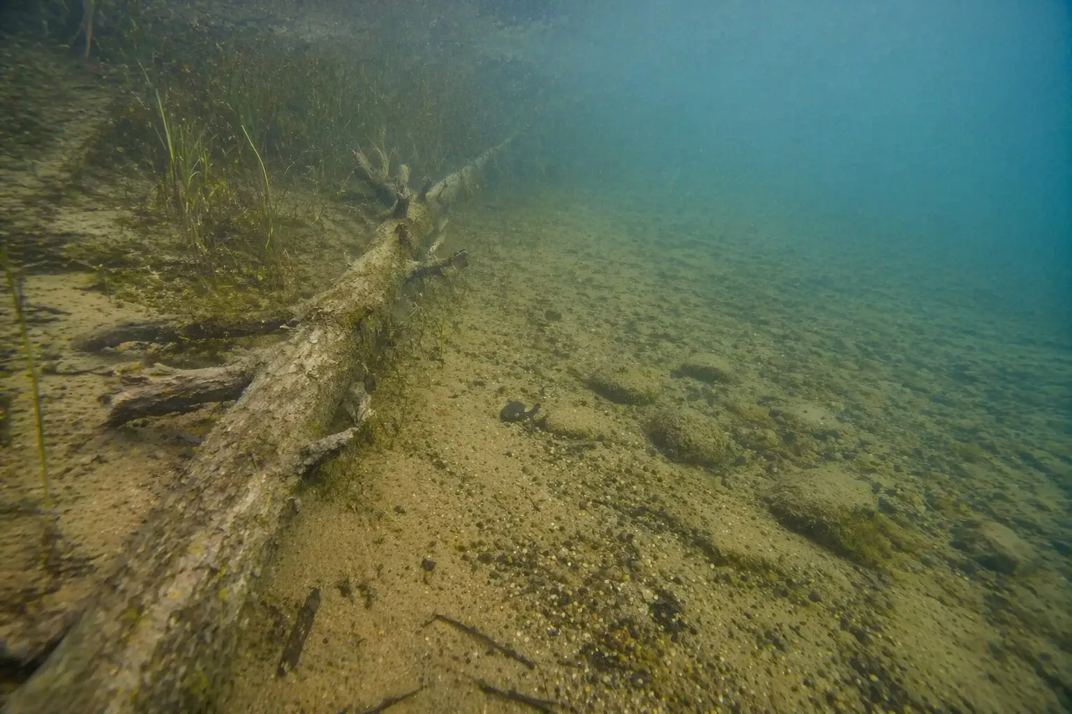
Real freshwater structure is messy: wood, grass, rock and bottom transitions all overlap below the surface. This prototype module shows how sonar returns can become a point cloud and an interactive terrain model.

Real underwater freshwater structure with submerged wood, grass, rock and bottom transition
Real underwater reference: cover, bottom texture and edges that are hard to judge from shore.
Real underwater reference
Shows the kind of hidden wood, grass and bottom transitions anglers are trying to read before casting.
Prototype visualization
Uses the existing 3D sonar reconstruction demo: point-cloud build-up plus an orbitable terrain model.
What it helps decide
Where structure starts, which edge is worth a cast, and when a spot deserves more time.
Kastave launch presale product bundle
Scan radius20 m
Use caseFreshwater
WorkflowDrop, cruise, decide
Launch price$1299
Pre-order offer$10 = 25% off